
15.10.22
Adieu TrackIR! Tobii tu es mon nouvel ami
Début Septembre, je craquais pour un Tobii. En fait, à cet époque, je ne savais pas que j'allais remettre au placard ma casquette, ses capteurs qui passaient leur temps à tomber et le petit récepteur qui trônait en haut de mon écran depuis plus de 15 ans. Au revoir TrackIR.
- Je n'ai rien à lancer avant Flight Simulator. Et je n'ai rien à mettre sur ma tête. Que j'ai un casque-micro ou pas, le contrôle de la vue par ma tête est disponible. Les réglages - point à améliorer - sont accessibles depuis MSFS.
- La précision est suffisamment bonne. Certes, il manque, un bouton pour bloquer la tête virtuelle et permettre ainsi de régler facilement tel ou tel bouton à la souris dans le cockpit 3D. C'est pourquoi j'utilise beaucoup mes petits boitiers sur mon bureau pour interagir avec le panneau Com/Nav de l'avion virtuel. On peut reseter et repositionner la tête dans une position idéale mais pas juste mettre en pause.
- Adieu les décrochages pour cause de lumière parasite. Même lorsque je sors du champs de capture du capteur Tobii, dès que j'y revient ma tête est virtuellement correctement placée.
- Il manque toute de même un des principes du 6DOF. Le fait qu'avancer sa tête lorsque l'on regarde simultanément à droite ou à gauche ne fait pas avancer vers la droite ou la gauche, mais vers l'avant. Le TrackIR sait faire ça (6DOF).
- Les deux derniers points sont corrigeables avec une application tierce comme FaceTrackNoIR. Mais je n'ai pas encore fait le pas. Ca ne va pas tarder! Restez sur la fréquence.
Espérons que le panneau de configuration dans MSFS pour le Tobii va s'améliorer. Pour voir mes réglages, rendez-vous sur ce message.
7.10.22
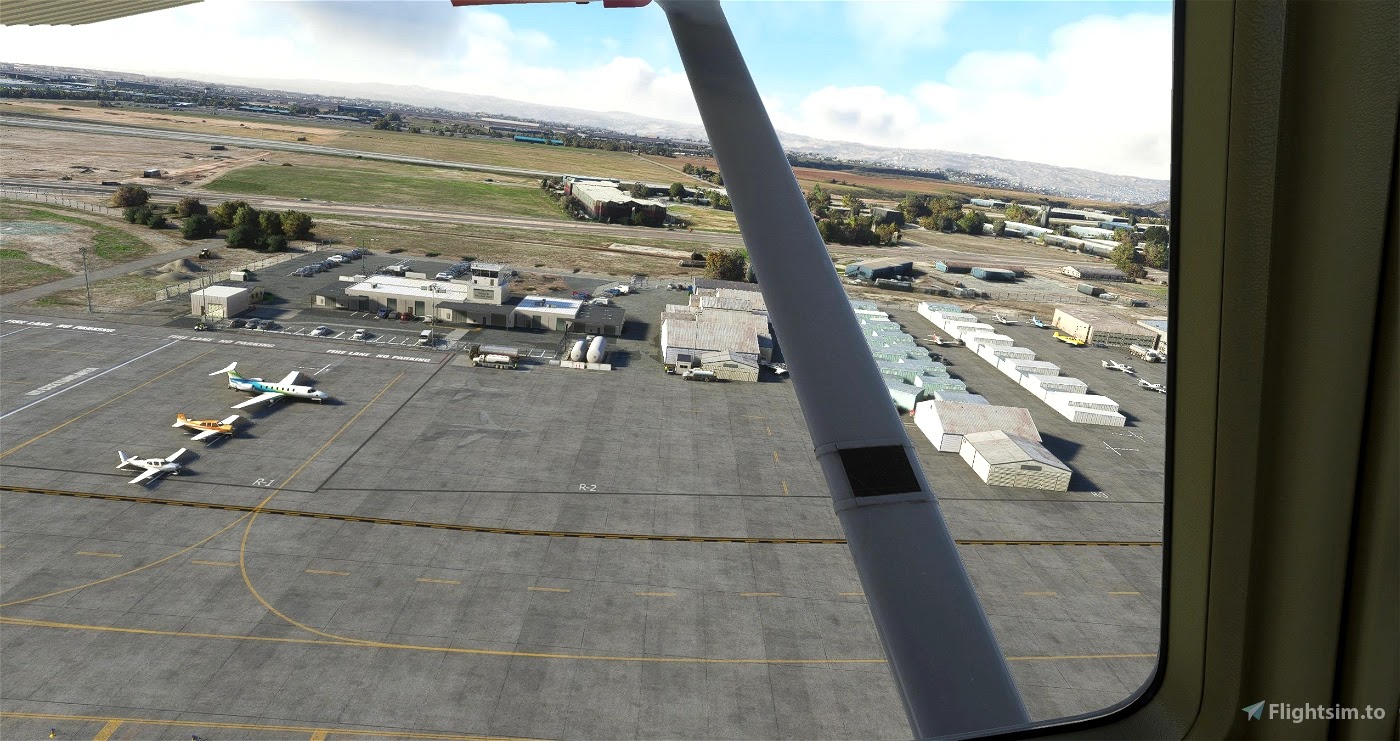
Le capteur Tobii dans Microsoft Flight Simulator 2020 lors d'un tour de piste à Ramona avec le Cessna 172 de WB-SIM
Cette vidéo a été enregistrée sans préparation, lors d'un vol test du capteur de tête Tobii et pour tester aussi ma scène de Ramona en Californie dans une météo limite-limite. Le tout avec Microsoft Flight Simulator 2022 (SU10, DirectX12 et DLSS sur "Balance"). Plusieurs enseignements listés dans ce message.
- Je me suis résolu à re-installer GeForce Experience pour l'enregistrement de vidéos et les captures d'images. J'avais écouté les forums et tous ceux qui conseillaient de désinstaller GeForce Experience, mais finalement après avoir utilisé d'autres outils pour la capture vidéo/image, j'en suis revenu à GeForce Experience qui fonctionne très bien chez moi et sans impact négatif.
- L'ambiance audio est fournie par FS-ATC-Chatter 1.2.1 qui renforme mon immersion quand je vole en solo. Je mets le volume assez bas pour ne pas couvrir l'ATC. Cela me permet de conserver un process dans ma tête qui écoute d'une oreille les messages même s'ils ne sont pas directement liées à ma situation. Comme si je surveillais une seconde fréquence COM2.
- Du côté du Tobii, je pense avoir trouvé un réglage convenable pour ma configuration, mais tous vos commentaires sont les bienvenus. Mise à jour 02/05/24:
- Eye vs Head Tracking Ratio: 1.00
- Eye Tracking Responsiveness: 050
- Head Tracking Sensivity:Pitch/Yaw: 1.50
- Center Stabilization: 0.30
- Head Tracking Sensitivity: Roll : 1.25
- Head Tracking Sensitivity: Position: 1.00
- Head Tracking Auto-center: 1

- Du côté du pilotage, c'est un vol "en vrac" comme on en fait tous, à l'aube (heure de Paris), sans voler au millimètre du manuel de vol, c'était juste pour tester MSFS et regarder un peu partout grâce au Tobii.
- L'avion est le WB-Sim Cessna 172, mod payant pour le C172 Classic des versions Premium/Deluxe de MSFS.
- Et la scène est la dernière version mise à jour hier (grâce aux données de l'excellente vidéo de la FAA "From the Flight Deck" que je vous recommande) de Ramona (KRNM) en Californie.
4.9.22
Tobii : après + de 10 ans avec le TrackIR, voilà mes premières impressions Tobii + MSFS
Je viens de réaliser mes tous premiers vols avec le Tobii et Microsoft Flight Simulator 2020, sachant que j'ai une bonne dizaine d'années de TrackIR derrière moi. Et je suis enthousiaste. Il me reste à le régler, certainement désactiver le Eye Tracking comme beaucoup et peut-être passer par FaceTrackNoIR pour affiner les réglages.
Pour ceux qui ne connaitraient ni Tobii, ni TrackIR: ce sont des solutions un peu concurrentes qui permettent de reproduire les mouvements de votre tête (devant votre PC) dans le jeu/simulateur. Si vous vous avancez, alors la vue dans le cockpit depuis le simulateur va avancer aussi. Quand vous tournez la tête de quelques degrés çà peine, la vue dans le simulateur va aussi tourner mais de manière démultipliée (évidement). La solution de Tobii détecte également où vous regarder sur l'écran et elle peut aussi se servir de cette info, pour simuler le déplacement de votre regard dans le simulateur.
Les toutes premières impressions sont en forme de "Qui veut m'acheter mon TrackIR v5" ?
Voici les + et les - après juste quelques tours de piste, toujours dans un avion à ailes hautes :
(+) La gestion de la profondeur (avancer/reculer) est bien meilleure qu'avec mon TrackIR ! Je n'ai plus de décrochage lorsque les capteurs sortent du champs du sensor TrackIR. Je peux m'avancer et reculer avec bien plus d'amplitude. Je me demande pourquoi le paramètre "Head Tracking Sensitivity - Position" est par défaut désactivé (0). Le mettre sur 1 active immédiatement la fonction!
(+) Tremblement ? Manque de précision ? Oui, peut-être mais pour mon usage et en l'état c'est peu perceptible et pas génant. Et encore... en désactivant le Eye Tracking (puisque le Head Tracking est lui activé) ça devrait être mieux. Peut-être aussi en jouant sur d'autres potars.
(-) Le manque de réglages fins: FaceTrackIR pourra certainement m'aider. On verra. J'affine avec ce que propose directement l'interface de MSFS et ça se trouve, ça me suffira.
(-) Le manque d'une commande PAUSE qui fige la détection, puis reprends d'où on a figé le mouvement (truc classique avec un TrackIR). Cette commande ne semble pas exister, sans passer par une interface supplémentaire comme FaceTrackNoIR. Mais finalement, comme je n'ai aucun décrochage, vais-je en avoir besoin ?
(+) Pas de casquette, ni de capteur à porter ! C'était la promesse et j'ai brigrement agréable. Et rien à lancer en parallèle de MSFS. Tout est intégré dans MSFS. Je changerais peut-être d'avis, si j'utilise FaceTrackNoIR, comme interface avec MSFS, pour avoir plus de réglages.
(+) J'ai pu activer Microsoft Hello qui déverrouille ma session Windows juste en mettant ma tête devant l'écran, tout comme je le fait avec mon portable pro 😉 C'est accessoire mais notable. Par contre, la fonction qui sur le Windows Task Switcher sélectionne la fenêtre en fonction de son regard est perturbante... surtout quand on ne sait pas qu'elle est activée par défaut! On a l'impression que son PC est envouté. Et pour info, ça se désactive directement depuis l'application Tobii Experience (et pas depuis les settings de Windows).
La suite au prochain épisode!
2.9.22
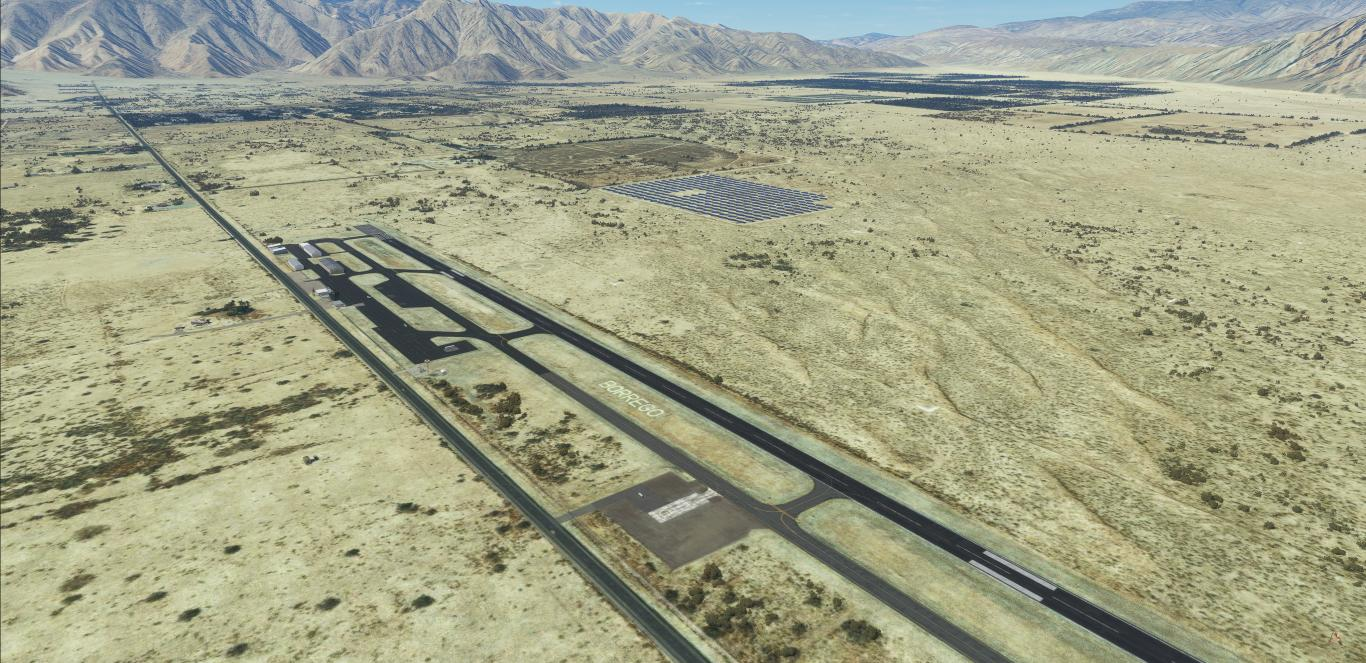
Borrego Valley Airport for MSFS Microsoft Flight Simulator 2020 (L08)
Encore une scène que je me suis amusé à créer pour Microsoft Flight Simulator 2020. Par défaut, Borrego est mal traitée par le moteur d'intelligence articiel qui tente d'identifier les bâtiments ;) Avec l'outil intégré Scenery Editor, c'est un peu comme faire du modélisme en plaçant à la souris des objets de la librairie. A côté de la construction, il y a aussi toute la partie recherche (merci Internet) pour savoir à quoi ressemble tel ou tel bâtiment, s'il y a un panneau spécifique ici ou là... et tenter de le re-créer avec mes modestes compétences. J'utilise BLENDER pour faire des panneaux et appliquer des textures faites avec GIMP. Et quand je suis fainéant, je fais des bitmaps avec Powerpoint (déformation professionnelle) à la vitesse de la lumière.
C'est dispo gratuitement par ici : https://flightsim.to/file/38247/san-diego-borrego-valley-l08

Borrego Valley Airport (ICAO: L08) is a county-owned public airport three miles east of Borrego Springs, in San Diego County, California, United States. Its one runway (8/26) is 5,011 x 75 ft (1,527 x 23 m) asphalt, CTAF/Unicom and host onsite restaurant "The Propeller Bar & Grill".


Download for free : https://flightsim.to/file/38247/san-diego-borrego-valley-l08
Author's note
As for all of my MSFS mod, this small scenery is made from a pilot-eyes perspective. In real, I'm a Plus One Flyers member and mostly fly from Montgomery Field (KMYF). I'm real PPL, but a rookie amateur scenery developer: this mod is made with 99% of MSFS default objects library and feature massive number of details. The scenery is inspired by aerial views from Bing and Google maps. It's a mix between the satellite imagery displayed from MSFS and more accurate data found on Internet. Unfortunately, there's no taxiway information nor in Jeppesen, FAA or Foreflight data. I did my best based on online video and online pictures. Hundreds of objects have been added to the default scenery to make in more live and bring a touch of an active area.

Borrego? The place-to-be for aerobatics
The International Aerobatic Club (IAC) has a practice and competition area just north of the airport (see white ground markings). Aerobatic pilots from California and the southwest US regularly use it for practice and major competitive events; Two annual competitions are sponsored by the San Diego Aerobatic Club, in April and October. Jump into your CAP 10 or Pitts!
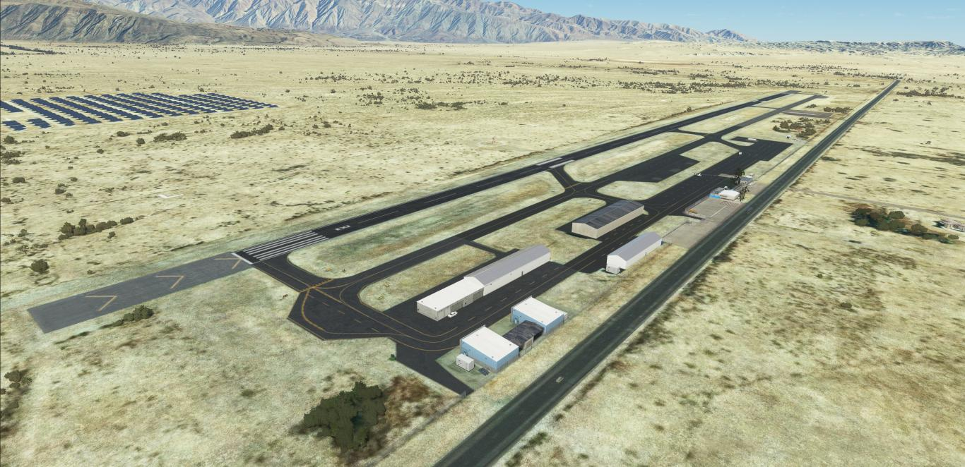

Features
- All taxiway markings verified and redesigned if needed. Mostly position correction and add of “Extended center line” at holding point.
- Fix the solar farm north of the field with handplaced solar panels
- Fix the color of re-asphalted taxiways and runway
- Fix and add correct windsocks
- Fix circuit pattern correct position
- Reveal the BORREGO letters marking on ground
- Reveal and improve the solar farm north of the field
- Add generic buildings to replace autogen MSFS: hangars, admin building, The Propeler restaurant and its upper deck…
- Add AWOS frequency 126.575
- Add Unicom 122.8
- Add PAPI’s at correct position


29.8.22
Brown Field Muni for MSFS Microsoft Flight Simulator 2020 (KSDM)
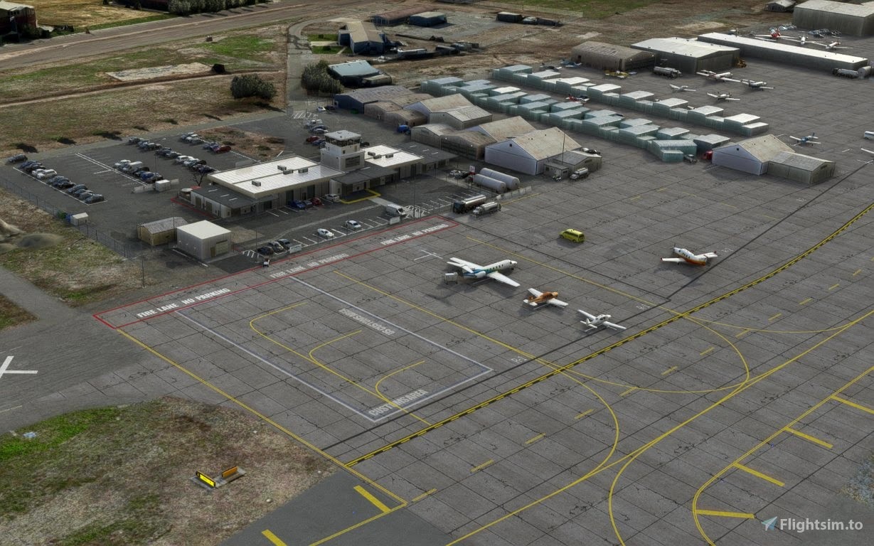
Peu de vols réels au programme ces temps-ci. Une histoire d'envie, de coût de l'heure de vol et de temps disponible. Alors, un peu comme pour revenir à l'origine de ce blog (c'est amusant d'écrire "blog" en 2022... si désuet), je continue le développement de petites scènes pour Microsoft Flight Simulator 2020. Après Montgomery, Ramona, Gillespie et Oceanside, voici Brown Field à la frontière mexicaine. Le terrain semble être la destination de choix pour les cFI du coin car il est très facile de le confondre avec Tijuana... juste de l'autre côté de la frontière.

Brown Field Municipal (ICAO: KSDM) is located 1.5 miles north of the U.S.-Mexico border in the Otay Mesa community of the City of San Diego.Brown Field Municipal is a busy general aviation airport. General aviation encompasses all aviation except air carrier and military, although the military continues to maintain a strong presence (look at FA-18!). The types of general aviation aircraft that operate at Brown Field Municipal include private, corporate, charter, air ambulance, law enforcement, fire rescue, flight training, cargo, skydiving, banner towing, helicopters and... airships.

All types of aircraft are welcome with the 7,972 ft main runway. Even the famous CONCORDE and the huge AN-225 landed there. Fuel (Jet and Avgas), plenty of hangars, maintenance, ATC in effect, 2 instrument approaches and RAIL, HIRL lightning.

Author's note
As for all of my MSFS mod, this small scenery is made from a pilot-eyes perspective. In real, I'm a Plus One Flyers member and mostly fly from Montgomery Field. I'm real PPL but a rookie amateur scenery developer: this mod is made with 99% of MSFS default objects library and feature massive number of details. The scenery is inspired by high resolution aerial views from Bing and Google maps. It's a mix between the satellite imagery displayed from MSFS and more accurate data found on Internet. 1000+ objects have been added to the default scenery to make in more live and bring a touch of an active area.

Features
- Add +800 objects manually set
- All taxiway markings verified and redesigned if needed
- Add generic buildings to replace autogen MSFS
- Add fences border all around the airport
- Add resurfacing patches on runways
- Add ATIS (132.35), Ground (124.4) and Tower (128.25) frequencies
- Add some banners and signs on public side/business area
- Add Cafe Landing Strip, First Flight School, Altitude Helicopters, EAA Chapter 14 hangars and apron
- Add AVFuel and Philipps66 (First Flight) fuel spots
- Add plenty of static planes at First Flight school apron (as real as pictures and satellite imagery)
- Remove several spikes around the field, cleanup of some monolith trees close by the field
- Remove un-wanted blue light poles
- Fix PAPI position
- Fix pattern circuit's position
- Fix and correct windsocks
- New ground markings on apron (mixed between uptodate and older satellite imagery)
- Improve US Customs and Border Protections Air Unit (north side of the field)
- A lot of Helipad available (training on south east side and USCBP Air Unit at the North)
- F18 at the ramp, as real as it gets (see below)


How to install?
Unzip the file into your Community folder. Keep the folder structure from the zip (\AirportServices \ContentInfo, \MaterialLibs, \scenery, layout.json and manifest.json at the root directory). Once installed go to KSDM as usual, the scenery is overlayed over the existing default one.

Requirements
- Free stocked MSFS installed : Sedona
- World Update II (USA) and X (USA)
Known bugs and limitation
- A huge tree may appear at the (new) ATC tower location
- Altitude Helicopters signs appears only at very close distance then stay visible, the same for two signs at the terminal (airside) called "Transient" and "Jet Center"
- The borders airport fences are not finished on east side.
Remarks
- The 2 jet fighters FA-18 at apron are not an error or a fantasy of the author. Brown Field was born as a army airfied then a Navy station (NAAS back in 50's) and with reduced hours at their air station in Miramar, Brown field allows the Marines to train on the weekends. It also reduces the time and cost of maintenance. Each time an F/A-18 lands at MCAS Miramar, it requires a full inspection, but that's not the case for other fields. Thus, you'll find often F18s at Brown Field!
- The main runway 08L/26R is huge 7'972 ft (2.4 km). It's one of the biggest in SOCAL. An Air France Concorde participated to the International Airshow in 1980 and 1988: https://youtu.be/G16hCcfrNTY?t=351 and https://www.flickr.com/photos/52810288@N05/6519379047
- "Low Poly GolfCart" (https://skfb.ly/6SKsJ) by apolodz is licensed under Creative Commons Attribution (http://creativecommons.org/licenses/by/4.0/)


1.8.22
Oceanside for MSFS Microsoft Flight Simulator 2020 (Bob Maxwell Memorial Airfield) (KOKB)

Centrally located in the heart of the beautiful Southern California coastline, Oceanside is considered the gateway city between metropolitan San Diego and Los Angeles. Located on 70-acres in the San Diego County area of California, the Bob Maxwell Memorial Field at Oceanside Municipal Airport (ICAO:KOKB) is a general aviation airport featuring a one runway (2712ft), Transient Parking and fuel services.
Free to download : https://flightsim.to/file/37328/oceanside-box-maxwell-memorial-airfield-kokb
As for all of my MSFS mod, this small scenery is made from a pilot-eyes perspective. In real, I'm a Plus One Flyers member and mostly fly from Montgomery Field. I'm real PPL but a rookie amateur scenery developer: this mod is made with 99% of MSFS default objects library and feature massive number of details. The scenery is inspired by high resolution aerial views from Bing and Google maps. It's a mix between the satellite imagery displayed from MSFS and more accurate data found on Internet. 1000+ objects have been added to the default scenery to make in more live and bring a touch of an active area.


Features
- Add all fences border all around the airport
- Add generic buildings to replace autogen MSFS
- Add specific information signs holding point 25
- Add Mercy Air and Reach helipads
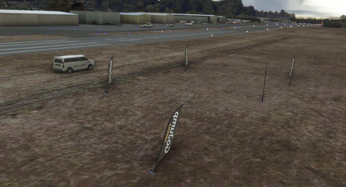
- Add GoJump America parachuting skydiving center and the dropzone north of the runway
- Add Airport bikes (free use, if you know where is the sign really located, please let me know!)
- Add Coastal Aero Scenic biplane
- Add resurfacing patches on runway 07/25
- AddASOS frequency 127.8
- Add CTAF frequency 122.725
- Add some banners and signs on public side/business area
- Add +500 objects
- Remove several spikes around the field
- Remove the Cinema Drive-In
- Remove undesired approach lights
- Remove of all taxiway signs
- Remove un-wanted blue light poles
- Fix circuit’s position runway 25 (right traffic)
- Fix windsocks
- Fix taxiways ground markings
- Limited use of default autogen buildings for business area


15.7.22
Gillespie Field (KSEE) for MSFS

Gillespie Field (ICAO:KSEE) is a county-owned public towered airport, 12 miles northeast downtown San Diego and the beach in California. The airport is mostly used for general aviation, with 3 runways. Gillespie is the home of San Diego Air & Space Museum Annex, the ASTREA (the air support unit of the San Diego County Sheriff's Department) and a dozen of other businesses and flight clubs/schools like my club Plus One Flyers.
Free to download : https://flightsim.to/file/36679/gillespie-field-ksee


As for all of my MSFS mod, this small scenery is made from a pilot-eyes perspective. In real, I'm a Plus One Flyers member and mostly fly from Montgomery Field but Gillespie is one of the fourth base. I'm real PPL but a rookie amateur scenery developer: this mod is made with 99% of MSFS default objects library and feature massive number of details. It is inspired by some of my personal videos and pictures but mostly by high resolution aerial views from Bing and Google maps. It's a mix between the satellite imagery display from MSFS and more accurate data found on Internet. More than 600 objects have been added to the default scenery to make in more live and bring a touch of active area.
Features
- Taxiway lines: complete redesign, position and correct type like "center line enhanced"
- Taxiway signs: complete redesign, correct name according to last charts, add some of the two sided taxiway sign (example at D5)
- Windsocks: correct placement and addition
- Ground markings: big TAXI yellow ground markings to avoid confusion with runways 27R and 27L and handcrafted (amateur) red intersection runway
- Night blue light poles: remove the maximum of undesired extra pole
- Buildings: all airport hangars/FBO's and buildings have been replaced by MSFS objects library.
- Fences: 90% of external fences and gates.
- Others: Reveal of Compass Rose west of the field on D1
Work-In-Progress
- More accurate enhanced taxiway ground marking (background darkest tone)
- Some missing taxiway signs (see "Request / I need you" below")
- Size of taxiway signs (currently "size 3") maybe too big. Your feedback are welcome.
- Some few segments of fences to close the field
- Parking spots should be verified
Requests
I need you : there're several specific signs on taxiways that I found like "ATC NON VISUAL AREA", "Be a Good Neighbor". These make the scenery unique and look for other I was unable to identify. If you have pictures, feel free to share with me! The tower is the autogenerated MSFS one. If you want to build a (light) blender object... you are welcome!
Not included: attention to night environment.

Very local taxiway signs (if you know others at KSEE, let me know!)

The compass rose at D1

Gillespie cafe, not exactly as the real one, but it looks like


Another very local sign

Circle Air and its fuel self serve

View from the tower apron

A lot of taxiway signs corrected and re-place

Apron of ASTREA, the air support unit of the San Diego County Sheriff's Department

SAA Flight Training and Maintenance
Inscription à :
Articles (Atom)

